


Day 16: I was able to descend Matacanes today! Bright blue sky and a couple puffy white clouds. I was on the bike riding from the hostel at 4:20 am today to meet Chuy’s group at the Cola de Caballo at 5am. His two guides, Edgar and Miguel, had 6 clients to lead down. We had a great time. I go so often with experienced people, and occasionally newbies to the sport but who do have some training, that it’s really interesting for me to see a group of people with no skills in a moderately difficult canyon. I think the folks today were exhausted by the end.
I suggested to Hans that we repeat the via ferrata, and he has another canyon in mind. At this rate I’ll never actually head south! At least the hostel is $12 per night.
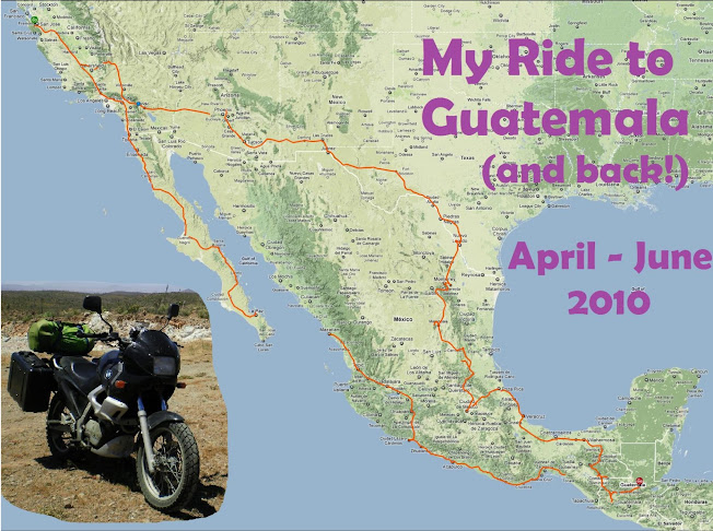
I am getting a little concerned about my goal. I am truly having a lot of fun here in Monterrey, but Bing maps is telling me it's around 1500 miles to Guatemala. I need to get on the road soon if I even have a hope of getting this accomplished...
Thank you Michelle for this post on Matacanes, we went with gaia xtreme tours it was so cool !
ReplyDeletehttp://www.gaiaxtreme.com
Next time let's do Hidrofobia
I am glad you enjoyed Matacanes! Hidrofobia is also a great canyon -- lots of fun. Keep adventuring!
ReplyDelete