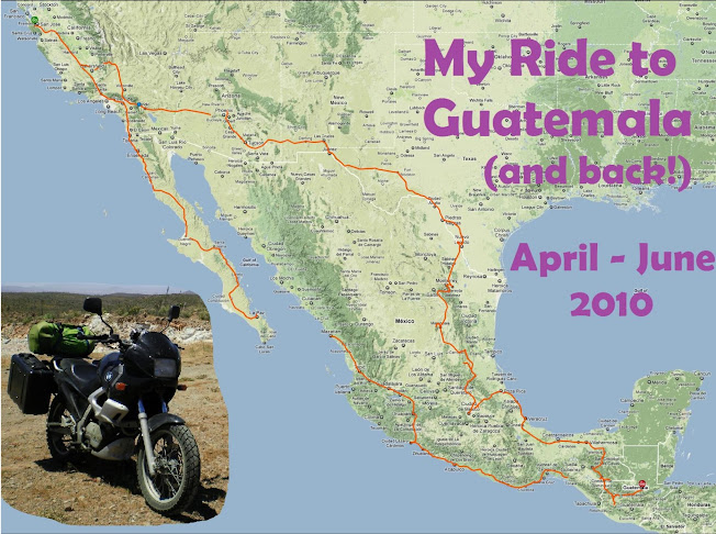
 Day 59 (afternoon) -
M I N D - B L O W I N G.
I have already used up all the superlatives I know, so I have none left to adequately describe how my last day riding in the mountains of Guatemala was. I just... have no words. I laughed (maniacally), I cried (very nearly), I screamed in frustration, I pounded my fist on bike, I swore at the country for keeping me a prisoner within... I stood in utter awe at the sights before me, I experienced things like never before...
I spent those last 45 Quetzales I had on a gallon and a half of fuel for the bike, and headed out in what I thought would be an easy, paved loop back to the border to Mexico. I didn't make it. Not this day, anyway.
The road wound higher, and higher, further north and away from the border, (and the road that my GPS showed). Then the pavement ended, and I rode for hours on graded dirt, through remote alpine forest. Eventually the dirt gave way to rough rocky cobblestone. For HOURS. I was so low on fuel and had no money left! There was no other traffic out there. The air was freezing cold and the wind howling -- I had the bike near 12000' and it was gasping for air. I was alone, on dirt roads, along mountain ridges with 6000’ drop offs on both sides. Dropoffs so intense I was getting vertigo. VERTIGO.
From time to time I would come across someone walking, and with EVERY person I stopped to ask if "this was the road to Nenton", the nearest large town I'd seen on the map. Two of them outright ran away from me into the woods. Of those that stayed to answer me (with the ones holding machetes I kept my hand on the throttle), I couldn't be sure with the answers they gave, if they were telling the truth or had no clue what I was saying and were just trying to be helpful. I tried to mix up the questions -- intentionally pointing the wrong way, etc., just to make sure they weren't automatically saying yes.
A pinnacle moment was when I had followed a dirt road for half an hour going down a ridge dividing two extreme mountain valleys, and came into a small cluster of houses. I stopped and asked a family sitting outside, if it was the road to Nenton. They stared at me for a second in disbelief, then started laughing. "No, the road to Nenton is over THERE" they said -- pointing 20 miles away at the other side of the valley, a 6000' deep chasm between. I had just coasted down the hill for 30 min conserving as much fuel as I could, and now had to throttle back up it. My rear brake had failed -- I guess there was some water in the line and it overheated.
Finally, after many hours, and just after twilight, I made it down into the jungly lowlands and stumbled into Nenton, finding a nice hotel for 30 Quetzales (~$4, which I paid using pesos). My last full day in Guatemala was one I'll remember for a long time.

No comments:
Post a Comment